Lundeborg Bælt (Lundeborg Belt) or Langelandssund (Langeland Strait)
When navigating this sea, where the water reaches depths of 8-9 metres along the Funish coast, the only dangerous shoal is Thurø Rev (Thurø Reef). Among the harbours in this area are Dageløkke and Lohals on Langeland and Lundeborg on Fyn. The Great Belt Strait begins at Hov, at the tip of Langeland.
Dageløkke Harbour was established in 1897. In the summer, Åsø Bro (Åsø Pier) and Dageløkke Harbour were popular destinations for Sunday excursions, and the local inn made sure that the visitors did not go hungry. First and foremost though, the harbour was a freight port and a landing site. Today, the harbour serves exclusively as a marina, and the nearby holiday centre and all the bathing visitors dominate the surroundings.
Just off the coast of Langeland is a series of shoals, which are named after inland toponyms: Korsebølle Rev (Korsebølle Reef), Helletofte Sand (Helletofte Sand Bar), Egeløkke Rev (Egeløkke Reef), Snøde Rev (Snøde Reef), Stoense Løb (Stoense Channel) and Skattebølle Røn (Skattebølle Shoal). The exception to this rule is Rødgrund (Red Shoal). Stoense Løb is located between Rødgrund and Skattebølle Røn and was previously used by smaller sailing ships navigating Stoense Harbour.
The Lohals spit is located further to the north – and later lent its name to the harbour and surrounding settlement. The town’s first harbour was established during the English Wars in 1807-1814. After the war was over, the harbour fell into disrepair and was replaced by a stone pier 18 metres in length and sheltered to the southwest. The pier was mostly used for the ferry service to Nyborg on Fyn and Skælskør and Korsør on Sjælland. In 1841, a total of 547 travellers used the harbour. The first steam liners, known as paddle steamers, stopped outside Lohals, and passengers were sailed by boat to and from the steamers.
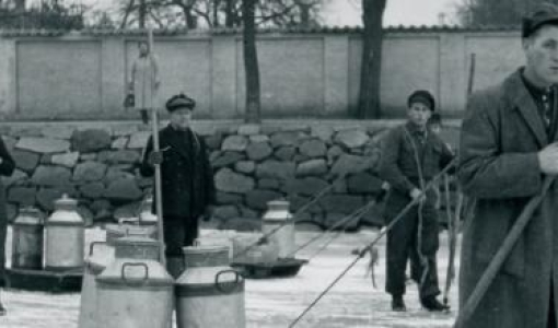
Around the turn of the century in the year 1800, shipping was an important industry on northern Langeland, and boatmen and skippers from Hou had decked boats and small cutters, with which they carried trade between Langeland, Fyn and Sjælland.
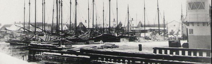
Lohals later became a ferry port. Beginning in 1897, Det Sydfyenske Dampskibsselskab (The South Fyn Steam Ship Company) operated the service between Lohals and Korsør, and from 1932 to 1963 the motor ferry called M/S Lundeborg crossed the sea between Lohals and Lundeborg. Lohals Harbour was dominated by local freight ships. The number of ships decreased gradually, but the real decline only began in the 1950s. Fishing was also an important occupation in Lohals, and in the inter-war period, it became the most important, with 30-40 motorised fishing vessels as well as a fishing association and a sales co-operative – but fishing, too, has lost its importance in the area. When the motorway bridge spanning the Great Belt Strait was opened in 1998, the ferry service between Lohals and Korsør shut down. Now, Lohals Harbour’s only assets are the pleasure crafts and tourists who visit the town in the summer.
Smørstakken and Smørstakkeløbet are located off the coast near Lohals. Smørstakken is a small islet, which is now under water, and the channel called Smørstakkeløbet just south of the islet is buoyed. From Smørstakken, the shoal continues northwards with shallow water and partly submerged rocks all the way to the sandy island of Vresen. There is, however, a buoyed channel near Kobberdybet. The old bearing is the spire of Svindinge Kirke (Svindinge Church) in line with the beacon at Teglgård.
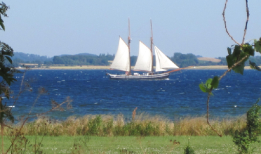
When sailing north along the coast of Fyn, past Thurø and the entrance to Skaarupsund (Skaarup Strait) near Skaarupøre, you will pass a small settlement on the beach. Further to the north, you will encounter two headlands called Aspelunds Hoved and Elsehoved. At the latter, a small sectored light is located on the beach. Two nautical miles further to the north, you will reach Lundeborg, which is surrounded by forests and has a great view towards Lohals. There are no difficulties involved in entering the harbour that contains a new marina shaped like a snail, and the old fishing and ferry port.
Today, Lundeborg is a popular holiday destination with large camping sites nearby, a sandy beach and a well-preserved harbour front dominated by the warehouse and the merchant’s house, which is currently being used for exhibits and as a restaurant. The harbour is also used by Oure Idrætsskole (Oure Sports School – located nearby), who own several boats, on which students are taught navigation and race against each other.