Drejø
The primary route to Drejø is through the Højesteneløbet channel, which separates Drejø and Hjortø. A fairway has been dug out in the channel, which is used by the ferry operating between Ærø and Svendborg. The twin buoys at the mouth of the channel are known among the locals as Hans and Rasmus – two brothers who worked at Svendborg Harbour.
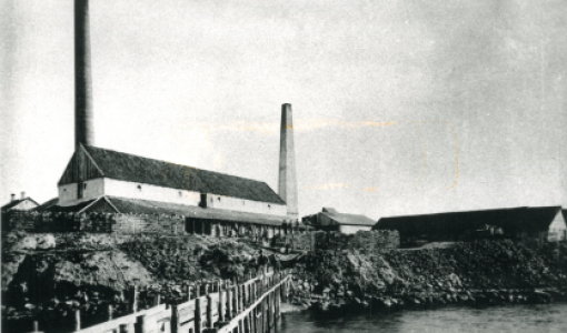
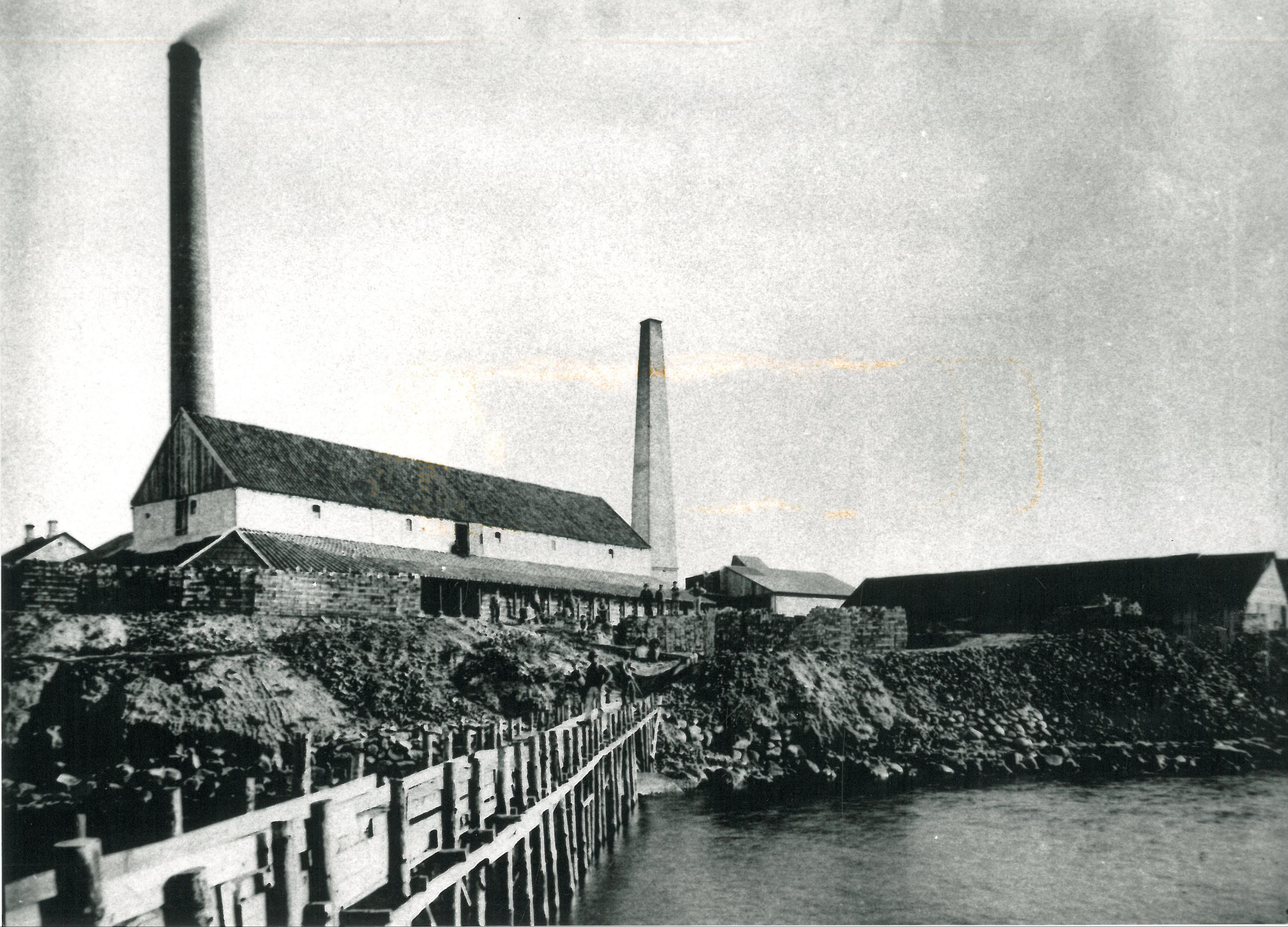
When the ferry service began, liaisons with the surrounding world became more common. In the evening, when the steam ship arrived, Drejø’s youth got together at the ferry pier to receive and ask for news, a custom, which was upheld well into the 1960s. The first ferry put into Gammelhavn (Old Harbour) in the north of Drejø in 1883. Gammelhavn is a small, well-preserved harbour, which dates far back, and whose well-preserved coastal environment still has its old sheds, slipway, drying ground and fishing houses. The modern ferry pier on the south of the island is newer, dating from 1905. The main island of Drejø was the centre of Drejø Municipality and parish. Drejø consists of the large main island – where you will also find Drejø Town – and the smaller, but more hilly Skoven (The Forest). The two islands are connected by a low isthmus called Drejet, which has lent its name to the island.
Back in 1921, Drejø had 298 inhabitants, but today, only 60 people live here. On the north side of Drejø, near Høllehoved, several seaweed walls have been preserved – they were used to reclaim land.
On Drejø Kirke (Drejø Church), there is a flood level mark from 1872 showing the high water level. However, occasionally, the change in water level goes in the opposite direction. After the storm of 1999, the water level around Drejø was extremely low – in fact, Gunnar Eriksen from the farm called Kildager was able to walk to the islet of Grydholm north of the entrance to Gammelhavn, and in the low water, he found a previously undiscovered Stone Age settlement.